

Moreton Island 4WD Guide: Ferry, Permits, Fuel & Tides

Last updated: October 2026
Big sandhills, freshwater lakes, fun 4WD tracks, shipwrecks you can snorkel and beach camping at its finest, all just off the coast of Brisbane. Moreton Island is the ultimate getaway if you’re after the adventurous island life, and it’s one of the best 4WD destinations in Queensland.
We took our Patriot Camper trailer across the Micat and spent five days exploring the island in winter. In this 4WD Moreton Island guide, we’ll walk you through everything you need to know before you go: how tog et there, which permits you need, how to drive the beaches and tracks, where to get fuel and supplies, and the best things to do once you’re there.


Moreton Island Summary
|
Where |
In Moreton Bay, about 40 km off Brisbane. Boat access only. |
|---|---|
|
Getting there with a car |
The Micat vehicle ferry from the Port of Brisbane, about 75 to 90 minutes. |
|
Vehicle |
A high-clearance 4WD. There are no sealed roads. |
|
Permits |
A vehicle access permit for your 4WD and a camping permit. Both from Mulgumpin Camping |
|
Fuel |
Only at Bulwer, in 20L jerry cans |
|
Shops |
Small stores with only the basics at Bulwer and Kooringal. |
|
Dogs |
Not allowed |
|
Phone reception |
Poor to none across most of the island. |
|
Best itme |
All year; winter for whales and firm tracks, summer for snorkelling. |
Moreton Island or Mulgumpin?
The Aboriginal name for Moreton Island is Mulgumpin, often translated as ‘place of sandhills’. Mulgumpin is a place of deep cultural significance to the Quandamooka people, the traditional owners of the island who have lived on and cared for this land for thousands of years.
The name ‘Moreton’ comes from Captain James Cook, who named the bay after the Scottish Earl of Morton, the president of the Royal Society in 1770. A spelling mistake in the published account of the voyage turned “Morton” into “Moreton”, and the name stuck.
How do you get to Moreton Island?
There’s no bridge, so you’ll arrive by boat one way or another. If you want to take your 4WD, the Micat is the only vehicle ferry.
|
Option |
From |
To |
Vehicles |
Good for |
|---|---|---|---|---|
|
Micat ferry |
Port of Brisbane (Lytton) |
Tangalooma Wrecks |
Yes |
4WD and camping trips |
|
Tangalooma passenger ferry |
Holt Street Wharf, Pinkenba |
Tangalooma Island Resort |
No |
Resort guests and day trippers |
|
Amity Trader Barge |
Victoria Point |
Kooringal |
Contact the operator |
Occasional runs to the southern end |
|
Sunday passenger launch |
Redcliffe Jetty |
Bulwer |
No |
A Sunday day trip |
|
Your own boat or jet ski |
– |
– |
– |
Experienced boaties |
The Micat Vehicle Ferry
We took the Micat with our 4WD and camper trailer. The terminal is at 14 Howard Smith Drive, Port of Brisbane, about a 40-minute drive from the Brisbane CBD. The crossing takes about 75 to 90 minutes, and you can land on the west coast right near the Tangalooma Wrecks. You can stay in your car during the trip, or head upstairs for coffee and breakfast with ocean views.
- Cost: our return trip with a 4WD and camper trailer was around $400 in the off-season.
- Book early: at least four weeks ahead for a weekend with your 4WD and up to six months ahead for school holidays, Easter, and Christmas.
- Check-in: the gates open an hour before departure, and you need to be there at least 30 minutes before. Utes go in lane 1, trailers in lane 2 and wagons in lane 3, and the crew comes to your car to check you in.
- Height limit: 3.6 metres
- Timetable: it runs on demand, with up to five departures a day in peak periods and fewer midweek in the off-season (none on some Wednesdays). Check before you plan your dates.
- Bookings: Micat Moreton Island ferry
Staying the night before? The ferry leaves early, so it’s worth staying overnight near the Port

Do you need a 4WD on Moreton Island?
If you’re only doing a day trip, no. You can walk onto the Tangalooma passenger ferry and stick to the resort area, or book a tour that includes snorkelling at the wrecks, sandboarding or join a 3-day 4WD trip around the island. It’s the easiest way to see Moreton Island without the planning.
If you want to camp and explore the island properly, then yes. You’ll need a high-clearance 4WD. There are no sealed roads, and everything is soft sand beaches and inland tracks. All-wheel-drive SUVs usually don’t have the clearance. Bring recovery gear, and if you can, travel with mates.
No 4WD, but want to camp? The Wrecks Camping Area is walk-in only and right beside the ferry landing.
➤ We’ve covered it in our Moreton Island Camping Guide.
Moreton Island Permits
You’ll need two permits to 4WD and camp on Moreton Island, and both are booked through Mulgumpin Camping, run by QYAC. You must have them before you arrive. Queensland Parks no longer sells Moreton Island permits.
- Vehicle Access Permit (VAP): one per vehicle, valid for up to a month, or you can buy an annual permit. Permits are $61.80 and non-refundable, and you can be fined for driving without one.
- Camping Permit: $7.75 per person per night, effective 1 July 2026, for a specific campground in our zone. See the Mulgumpin camping fees page.
Print or download both before you leave home. You won’t be able to get them up once you’re on the island.

4WD Moreton Island: how to drive the beaches and tracks
Moreton Island is the third-largest sand island in the world, and it’s a 4WD paradise: long beach runs at low tide, and inland tracks through soft sand and thick bush. It’s also easy to get stuck, so drive with care.
Tide Times
Checking the tide times is the most important part of planning a 4WD Moreton Island trip. Drive on the beach within two hours either side of low tide, and avoid driving two hours either side of high tide. Some beaches, including parts of the western beach south of Tangalooma and the South West Camping Zone, are impassable at high tide.
The tides on the eastern beach of the ocean run about 50 minutes earlier than at Tangalooma, and Kooringal is about 15 minutes earlier. You can check the Moreton Island tide times online. Download or print them before you go, as mobile reception is patchy.
Tyre pressures
Let your tyres down before you drive off the ferry. Somewhere between 16 and 20 psi is a good start for most vehicles. Check your vehicle’s manual, and pump them back up before you get back on the bitumen. There’s air at the Port of Brisbane terminal when you return. If you have traction control, turn it off on soft sand!
Speed limits
All Queensland road rules apply: you need a license and registration, everyone wears a seatbelt, and nobody rides outside the car.
The main tracks
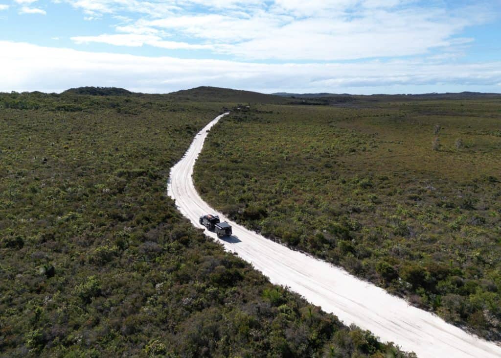
- Middle Road crosses the island from Tangalooma to the Eastern Beach. It’s narrow and one-way, and the sand gets soft and deep in summer. We did it in winter with our camper trailer, and the sand was firm. In summer, avoid it with a trailer.
- Bulwer-Blue Lagoon Road is the better way to the east coast if you’re towing.
- Bulwer- North Point Road takes you to the northern tip. It’s a beautiful drive.
- Bypass tracks such as the Cowan Bypass and the Tangalooma Bypass take you around the townships and the resort, where the beach is closed to vehicles. Traffic comes both ways, so take them slowly.
It takes about 50 minutes to drive from Cape Moreton to Tangalooma via Middle Road.
Moreton Island Map
Every campground, camping zone, track and highlight on Moreton Island.

Beach driving tips
- Stay off the dunes and vegetation, only drive on formed tracks.
- Cross creeks slowly. Freshwater creeks run across the beaches and can leave steep drop-offs after rain.
- Watch for people, wildlife and campers on the beach.
- Ask the Micat staff about the current state of the beaches and tracks before you drive off.
Latest conditions
Always check the Mulgumpin (Moreton Island) conditions report before you go. At the time of writing (October 2026):
- The beach between Kooringal and Tangalooma isn’t always passable because of debris and shifting sand.
- Kooringal is reached at mid to low tide on the western beach or via the She Oaks track from the eastern beach due to severe erosion.
- The beaches in front of Cowan Cowan and Tangalooma Island Resort are closed to vehicles.
- Some campsites are closed after storm erosion damage.
Insurance
Before leaving on your trip to Moreton Island, double-check your insurance to see what kind of support they offer if you get stuck and can’t recover your vehicle safely. Club 4X4 has an off-road recovery cover that gives us peace of mind when we’re exploring remote places such as Moreton Island.

Fuel and Shops on Moreton Island
Is there fuel on Moreton Island? Yes, but only just. Castaways at Bulwer sells unleaded and diesel in 20L jerry cans (you can pay a deposit on the can), and it’s a lot more expensive than on the mainland. Fill up before you leave Brisbane and bring a spare jerry can if you’re planning a lot of driving.
There are two small stores on the island:
- Castaways at Bulwer, on the north-west side: a cafe and licensed store with holiday basics like bread, milk and ice, plus fuels in jerry cans. It’s about a 20- to 30-minute drive north of the ferry landing. When we visited Moreton Island in winter, it was closed, so don’t count on it. Bring everything you need.
- The Kooringal General Store and Gutter Bar on the southern tip: a pub, restaurant and general store with groceries, drinks, ice, bait and beach gear. No fuel. It’s open seven days (closed Christmas Day), with longer hours in the school holidays.
You can also buy ice at the Micat terminal and on board. Bring enough food and water for your whole trip, and treat the stores as a backup.
Drinking water
There’s no treated drinking water on the island. The campgrounds and a few water points (Big Sandhills, Rous Battery and Eagers Beach) have untreated water, so boil or treat it before drinking, or bring your own.
Is Moreton Island Dog Friendly?
Unfortunately not. Domestic animals aren’t allowed anywhere in the national park or recreation area, which covers almost all of Moreton Island, and dogs arriving by boat must stay on board. It’s to protect the island’s wildlife. If you want to take your dog beach camping, try Inskip Point near Rainbow Beach instead.
Is there reception on Moreton Island
Very little. Coverage is poor or non-existent. You have a better chance near Tangalooma Resort. Download your tide times, map and permits before you arrive.
Best time to visit Moreton Island?
You can visit the Island all year round, and each season offers a different experience.
- Summer (December to February) is ideal for snorkelling and swimming, you’ll have warmer waters and longer days. But this is also the busiest time of year.
- Winter (June to August) is when we went. It’s cooler and the days are shorter, but we saw so many humpback whales passing by, and in the evenings we cosied up next to the campfire. Whales pass from June to November.
- Spring and autumn are the sweet spots: warm, quieter and good driving conditions.
We always try to avoid the crowds by not going on weekends or during school holidays.
Things to do at Moreton Island
There are so many things to do on Moreton Island that you could easily spend five days or more. These are our favourites.
➤ If you’d like them in a day-by-day plan, follow our 5-day Moreton Island camping itinerary.
Snorkelling at the Tangalooma Wrecks
You can’t visit Moreton Island without snorkelling at the Tangalooma wrecks. Fifteen vessels were deliberately sunk here between 1963 and 1984 to create a safe anchorage for boats, and they’ve become an artificial reef with corals and over 100 species of fish. If you’re lucky, you’ll spot dolpings, wobbeongs or even a dugong.
The wrecks are just north of the resort and right by the Micat landing. Be careful of the current! It was very strong when we went out; there are no lifeguards, and jet skis and boats use the water between the beach and the wrecks. If you’re not a strong swimmer, book a guided snorkel tour that takes you out by boat.

Swim or Paddle at the Blue Lagoon
The Blue Lagoon is the largest freshwater lake on the island’s east coast, between Middle Road and Cape Moreton. It’s lovely for a swim, and a great place to launch your SUP or kayak. Don’t expect it to be blue, though… The water is tea-coloured from the surrounding tea trees. We had the little beach to ourselves in winter, but it gets busy in summer.

Hike Mount Tempest
At 280 metres, Mount Tempest is the highest point on the island and reputedly the highest stabilised coastal sand dune in the world. The Mount Tempest Lookout track is 2.2 km return, graded difficult, and takes about two hours. It’s a steep climb, but the 360-degree view over Moreton Island is worth every step. From the western beach, it’s 6 km along Middle Road to the turn-off, then 2.4 km to the car park.

Visit Cape Moreton Lighthouse
A visit to Cape Moreton is a must for history lovers. The red-and-white lighthouse was first lit in 1857, making it Queensland’s oldest, and it sits at the island’s north-eastern tip. There’s an information centre, and the view from the top is the best spot on the island for whale watching from June to November. We spent a few hours here just watching whales go by.

Surf North Point
If you surf, North Point has a great right-hand point break, and the eastern beaches have exposed surf breaks. They’re remote, unpatrolled, and there are no shark nets, so only surf within your experience and never alone.

Sandboard the big Sandhills and the Desert
The Big Sandhills on the south-west coast and the Desert near Tangalooma are great for sandboarding, or just a walk to the top for the views. You can buy a sandboard (with wax) at the Micat terminal or at Castaways in Bulwer.

Go Fishing
Moreton Island is a great place for beach fishing, with plenty of spots along the coast. Bring your own gear. Bait is sold on the Micat and at the Kooringal store. Check the marine park zoning before you drop a line, as parts of the bay are green zones.
Champagne Pools
Do you want to enjoy a natural ocean pool? Relax and find yourself in this natural sandy-bottomed sea bubble bath with water foam and bubbles at North Point.
Fish and chips at the Gutter Bar
At the southern tip of the island, Kooringal’s Gutter Bar is a pub, restaurant, and general store with a great island vibe. It has some of the freshest seafood and coldest beers on the island, and the fish and chips are delicious. Remember the beach access to Kooringal is tide-dependent.
Where to stay on Moreton Island
Camping
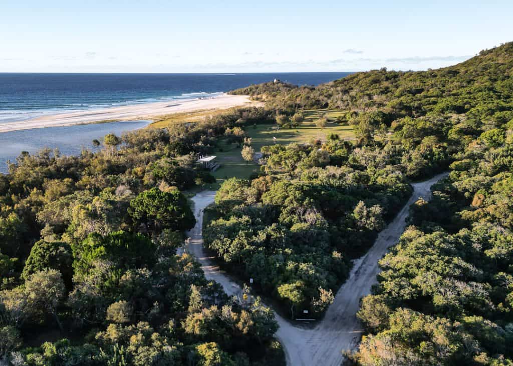
Camping at Moreton Island was one of the most memorable experiences we ever had. There are five campgrounds and five beach camping zones, ranging from sheltered bush camps to beach camping with no one else around. Our favourites were North Point Campground and the North West Camping Zone.
➤ We’ve compared all ten, with facilities, fires and trailer access in our Moreton Island Camping Guide.

Not camping?
- Tangalooma Island Resort, on the west coast, has hotel rooms, apartments and villas, plus the passenger ferry from Brisbane.
- Castaways Moreton Island, at Bulwer, has apartments and glamping
- Holiday Houses at Bulwer, Cowan Cowan and Kooringal
What to pack to 4WD on Moreton Island?
Bring everything you need for your whole stay. The essentials:
- Plenty of drinking water and food
- Recovery gear: recovery boards, shovel, tyre deflator, snatch strap and compressor
- A spare jerry can of fuel
- A SURVIVAL first aid kit
- Sun protection: sunscreen, sunglasses and a Will & Bear wide-brimmed hat (Get 10% off with the code BUSHANDBAY)
- Insect repellent
- Firewood
- A portable toilet if you’re camping in a zone
- Snorkelling gear
- Strong, lockable containers for food and rubbish (there are feral pigs on the island)
- Muk Mats to keep the sand out of your camper – Get $10 off with the code BUSHANDBAY
How much does a trip to Moreton Island cost?
We spent about $825 for the two of us on a five-day camping trip, including the Micat for our 4WD and camper trailer, the vehicle permit, camping permits, fuel and food.
➤ You can find the full breakdown with 2026 prices in our Moreton Island Camping Guide.
tips for visiting Moreton Island
To wrap things up, here are some final tips to make your trip unforgettable:
- Always plan ahead: book your permits, ferry and campgrounds/zones
- Check weather conditions and tides before you go
- Respect the environment by staying on the marked tracks
- Don’t swim in the ocean unless you’re confident
- Take all your rubbish with you, leave no trace
Moreton Island FAQs
How do you get to Moreton Island with a car?
On the Micat vehicle ferry from the Port of Brisbane at Lytton. It takes about 75 to 90 minutes and lands near the Tangalooma Wrecks. It’s the only ferry that takes vehicles.
Do you need a 4WD for Moreton Island?
For a day trip, no: take the passenger ferry or a tour. To drive and camp around the island, yes, a high-clearance 4WD with low range.
Do you need a permit to drive on Moreton Island?
Yes. Every vehicle needs a vehicle access permit from Mulgumpin Camping before it arrives on the island. It’s valid for up to a month.
Is there fuel on Moreton Island?
Only at Castaways in Bulwer, sold in 20-litre jerry cans at island prices. There’s no service station.
Are there shops on Moreton Island?
Two small ones: Castaways at Bulwer and the Kooringal General Store (home of the Gutter Bar) on the southern tip.
Can you take dogs to Moreton Island?
No. Pets aren’t allowed in the national park or recreation area.
Is there phone reception on Moreton Island?
Very little. Download your tide times, map and permits before you go.
What is the best time to visit Moreton Island?
Any time. Winter is best for whales and firm tracks, and summer is best for snorkelling and swimming. Avoid school holidays and weekends for fewer crowds.
Can you drive to Moreton Island?
No. There’s no bridge. You take your 4WD across on the Micat ferry.
How long should you spend on Moreton Island?
At least three days to see the highlights with a 4WD, and five days if you want to see the whole island without rushing.
Is Moreton Island worth it?
Absolutely. For 4WD and beach camping lovers, Moreton Island is hard to beat: shipwrecks, whales, freshwater lakes, sandhills and incredible sunsets on the west coast. All a short ferry ride from Brisbane. Plan ahead, respect the tides and enjoy everything Moreton Island has to offer!
Happy Travels!
Planning your Moreton Island Trip
- Moreton Island camping: all 10 campgrounds and camping zones compared.
- 5-day Moreton Island camping itinerary: our day-by-day route around the island.
More 4WD beach trips → Camping at Double Island Point | Teewah Beach Camping | Stockton Beach Camping
The content on Bush and Bay is based on our personal experiences and opinions. While we strive to provide accurate, up-to-date information, travel conditions and recommendations may change over time. We do not take responsibility for any decisions or actions made based on our content. Always conduct your own research and consult with professionals where necessary. Bush and Bay may earn a small commission from affiliate links, but this does not influence our reviews or recommendations. We only endorse products and places we have personally tested and believe in.
