

Moreton Island Itinerary: 5-Day 4WD camping trip

Last updated: October 2026
A remote paradise accessible only by 4×4 and just an hour from Brisbane. Welcome to Moreton Island! This Moreton Island Camping itinerary lays out five unforgettable days on the island, the same route we drove when towing our Patriot Camper Trailer.
We’ll take you through the best beach camping zones and campgrounds, what to expect on the inland 4WD tracks, how to time each day with the tides, and the best things to do along the way.
Do you prefer watching over reading? Check out our YouTube video where we explore Moreton Island for 5 days with our Patriot camper trailer.
Your 5-day Moreton Island Itinerary Overview
|
Day |
Route |
Highlights |
Where to camp |
|---|---|---|---|
|
1 |
Ferry to Tangalooma, drive north up the west coast |
Bay sunsets, Glass House Mountains Views on a clear day |
North West Camping Zone |
|
2 |
Bulwer-North Point Road to the northern tip |
North Point, Honeymoon Bay, Champagne Pools |
North Point Campground |
|
3 |
Cape Moreton, then south along the eastern beach |
Lighthouse, whales, Blue Lagoon |
Blue Lagoon, North East zone or back to the west |
|
4 |
Middle Road to the west coast |
Snorkelling at Tangalooma Wrecks |
Ben-Ewa, North West Zone or the Wrecks |
|
5 |
Middle Road, eastern beach, Kooringal, west coast |
Mount Tempest, the Gutter Bar, Big Sandhills |
Ferry home |
Moreton Island Map
Here’s every campsite and track from this itinerary in one map.

Before you go
Planning is key when exploring Moreton Island, and trust us, it’s worth the effort. Here are the essentials for this itinerary. For the full details, read our Moreton Island Camping Guide and our 4WD Moreton Island guide before you go.
The Micat Ferry

To take your 4WD to Moreton Island, you’ll need to book the Micat ferry from the Port of Brisbane. The terminal isa bout a 40-minute drive from the Brisbane CBD, and the crossing takes about 75 to 90 minutes. You can stay in your car or head upstairs for a coffee and breakfast.
- Cost: we paid about $400 return for our 4WD and camper trailer (off-season, no weekend)
- Book early: especially when you’re travelling during school holidays or long weekends
- Bookings: Micat Moreton Island ferry
The ferry leaves early, so it’s worth staying near the Port the night before.
Moreton Island Tide Times
As soon as you arrive at Moreton Island, the fun begins. You get around by beach and sand track, so the tides decide your day. Plan your beach driving within two hours of low tide, and avoid driving on soft sand around high tide. Each day below tells you when to go.
Check the Moreton Island tide times before you arrive, and download or print them, as mobile reception is patchy. Remember the eastern beach tides run about 50 minutes earlier than at Tangalooma.
Moreton Island Permits
You’ll need two permits for this trip, both from Mulgumpin Camping, which is run by the Quandamooka Yoolooburrabee Aboriginal Corporation (QYAC):
- Vehicle Access Permit
- Cost: $61.80 per vehicle for up to one month. Book your 4WD permit
- Camping Permit
- Cost: $7.75 per person per night from 1 July 2026, booked for each night and each site. Book your campsites.
Mulgumpin emails your tent tags 5 days before you arrive. Print them, seal them in a snap-lock bag and attach them to your tent or camper.
5-Day Moreton Island Camping Itinerary
Day 1: Arrival and exploring the West Coast
Start your journey at the Micat Ferry Terminal, located at 14 Howard Smith Dr, Port of Brisbane QLD 4178. You can find it on Google Maps. The gates open 1 hour before departure. After the gate has opened, you’ll need to proceed to one of the following lanes: Utes – Lane 1 | Trailers – Lane 2 | Wagons – Lane 3. There’s no need to leave your vehicle once you’re in the lanes. One of the crew members will come to you to complete the check-in process.
TIP: Make sure to deflate your tyres before you arrive on the island. We dropped ours to around 15 psi with the camper trailer.
The ferry arrives around 90 minutes later on the West Coast of the island, near the Tangalooma Wrecks. Head North to find a campground in the North-West Camping Zone. This zone lies between the Ben-Ewa and Comboyuro Point campgrounds. There are 74 beach campsites to choose from. They come in different sizes, and you will find some secluded spots, as well as social camping areas.
We chose a spot near Bulwer, and had to take the Cowan Bypass to get there. It’s an easy bypass, but traffic comes in both directions so be careful when driving in and out.
When you find a spot, set up camp, relax, and enjoy the calm waters of the bay. On a clear day, you might even spot the Glasshouse Mountains from your campsite.
The best thing about this camp zone? You can watch the sunset!


Day 2: North Point and Honeymoon Bay
Today you’ll head to North Point via the inland track Bulwer North Point Road. When you arrive at North Point, you’ll need to take a second to take it all in. It’s jaw-dropping beautiful and for us the most beautiful spot on Moreton Island.
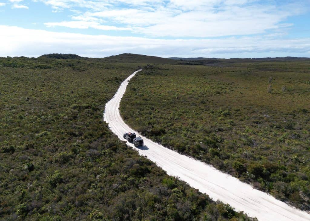

Time it right: aim to arrive around two hours before low tide. That gives you plenty of time to explore, go for a surf, or spot some whales passing by between June and November.
Tonight, you’re staying at North Point Campground. This campground has spacious grassy sites, cold showers and toilets. Only four of its 21 sites take camper trailers, so book early if you’re towing. You’ll need to cross a creek on the North Point Cape Moreton Track to get in, so make sure you arrive before the tide comes in. And campfires aren’t allowed here.
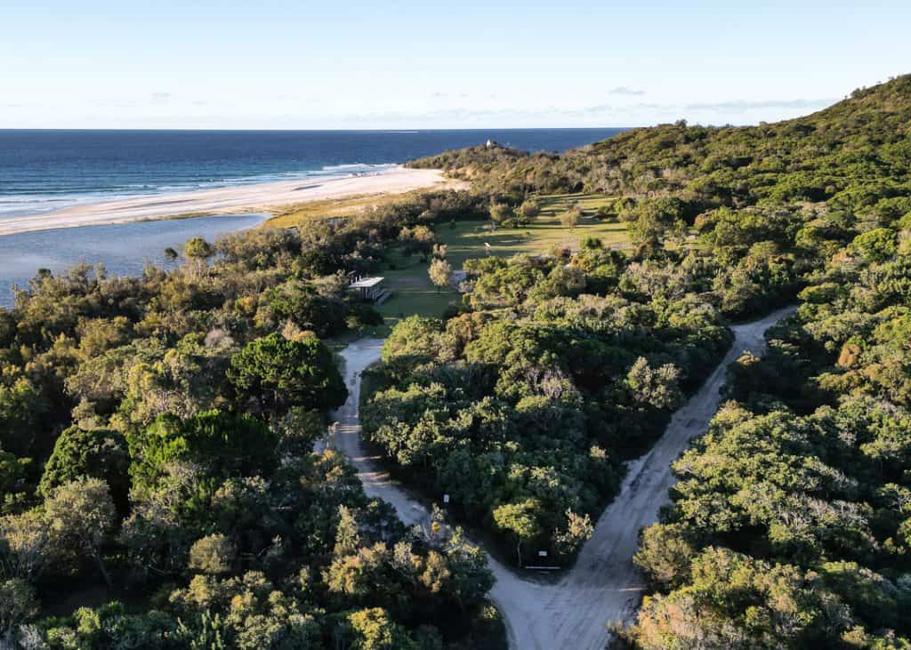
North Point Campground is only about 500 metres (walking distance) from the beautiful Honeymoon Bay. This picturesque bay is just stunning; it’s like a beach you’d only see in the movies. It’s a great place to relax while enjoying incredible views.
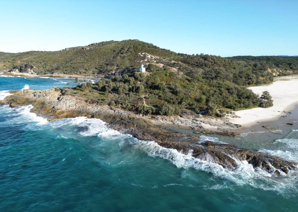
From Honeymoon Bay, you can walk up the headland with the white lighthouse, then head back down the other side towards Moreton Island’s Champagne Pools. This natural pool gets its name from the sparkling ‘champagne’ effect created by the waves as they crash over the rocks. Enjoy the foam and bubbles while soaking up the sun in this sea bubble bath.
A great way to end the day is by watching the sunset. Grab some snacks, a beer or a wine, and head to a private little beach for sunset. From the campground, you can walk down the path next to the outdoor shower and it brings you to this private little beach, with views over North Point and the Glasshouse Mountains.
Day 3: Cape Moreton Lighthouse and Blue Lagoon
You’ve probably fallen in love with Honeymoon Bay yesterday, so if you feel like waking up early, go and watch the sunrise over this beautiful bay. It’s a great way to start the day, and I guarantee you won’t regret waking up early.

After your coffee and breakfast, it’s time to leave North Point Campground and continue east on the North Point-Cape Moreton track to Cape Moreton Lighthouse.
Here, you can visit the information centre and take a walk up to the lighthouse. This iconic red-and-white lighthouse was first lit in 1857, making it the oldest in Queensland. The view from the top is incredible, and when visiting in winter (from July to November), this place is by far the best spot on the island for whale watching.
From the lighthouse, take the track down to the eastern beach and drive south towards the Blue Lagoon. When you arrive at the Blue Lagoon, you probably want to set up for a few hours. This 42 hectares of fresh water is a great spot for SUPping, kayaking and swimming. But don’t get fooled; the Blue Lagoon is not blue. It has a beautiful brown colour thanks to tea tree oils.

Where to camp tonight depens on the tides and the wind:
- Blue Lagoon Campground, with toilets and cold showers, a short walk from the lake.
- The North East Camping Zone, for beach camping and sunrise over the ocean.
- Back on the west side, if it’s too windy on the east coast
If you head back west, drive south along the beach to Middle Road, the inland 4WD track that crosses the island. It’s narrow and one-way, and runs through dense bushland. When we did it in winter, the sand was firm and easy to do with our camper trailer, but in summer it’s best to avoid Middle Road with a trailer. Use the Bulwer-Blue Lagoon Road instead. On the west side, find a spot in the North West Camping Zone or book a site at Ben-Ewa Campground, and watch another epic sunset.
Day 4: Snorkelling at the Tangalooma Wrecks
Today is the day you’ve probably been waiting for! It’s time to go snorkelling at the iconic Tangalooma Wrecks. Drive South to the wrecks, or if you camped on the other side of the island, take the inland track, Middle Road.
Snorkelling the wrecks is a bucket-list item and a must-do on Moreton Island. Fifteen vessels were sunk here between 1963 and 1984 to create a safe anchorage for boats, and coral has grown in and around them. They’re now home to over 100 species of fish, and if you’re lucky, you might spot dolphins, wobbegongs or dugongs.
Be careful here! You can swim out to the wrecks from the beach, but there’s a very strong current between the beach and the wrecks when the tide is running. It’s unpatrolled; there are no lifeguards, and boats and jet skis use the channel. We felt the current as soon as we got in. If you’re not a strong swimmer, book a guided snorkel tour, which takes you out to the wrecks by boat with all the gear. Kayaking around the wrecks is a fun option too if you’d rather stay out of the water.
After an unforgettable beach day, set up camp at Ben-Ewa or in the North West Camping Zone. If you’re in a tent without a vehicle, you can also pitch it at the Wrecks Camping Area. You’ll want to be close to Middle Road for tomorrow’s adventure.

Day 5: Climb Mt Tempest and lunch at the Gutter Bar
After a few days of camping, finish the trip with something active: climbing the highest point on the island. At 280 metres, Mount Tempest is reputedly the highest stabilised coastal sand dune in the world. From the western beach, drive 6 km along Middle Road to the turn-off, then 2.4 km to the car park. The walk is 2.2 km return and takes about two hours. It’s a steep climb, but you’ll be rewarded with a breathtaking 360-degree view over Moreton Island.

After that steep climb, you deserve a filling lunch at The Gutter Bar on the southern end of Moreton Island. To get there, continue on Middle Road towards the East Coast and head south along the beach. At Sovereign Beach, take the inland Mirapool Bypass Track and the Short Point Kooringal Track towards Kooringal.
Check the conditions first. At the time of writing, severe erosion means Kooringal can only be reached at mid to low tide on the western beach, or via the She Oaks track from the eastern beach, and the stretch of the western beach between Kooringal and Tangalooma isn’t always passable. Check the Mulgumpin conditions report before you go.
The Gutter Bar is a restaurant, bar and general store with a great island vibe! Enjoy some delicious fish & chips, and grab something sweet for the way up.
As soon as it’s low tide, start making your way back north. The drive alongside the South West Coast is breathtaking but impassable at high tide. You’ll pass the Big Sandhills, where you can go sandboarding, slide down the hill, or enjoy the view from the top.

Leave enough time within the low-tide window to get back to the ferry, and arrive at least 30 minutes before your departure. Then it’s tyres back up at the terminal and safe travels home!



Only have three days? A shorter Moreton Island Camping Itinerary
If you’ve only got a long weekend, this is how we’d do it:
- Day 1: Ferry to Tangalooma, snorkel the wrecks if the tide suits and camp in the North West camping zone.
- Day 2: Bulwer-North Point Road to North Point, Honeymoon Bay, the Champagne Pools and Cape Moreton Lighthouse. Camp at North Point or Blue Lagoon.
- Day 3: The Blue Lagoon in the morning, Middle Road back to the west coast (with a stop at Mount Tempest if you feel like being active), then the ferry home.
You’ll miss the southern end and the Gutter Bar, but you’ll see the island’s highlights.
Where to stay on this Moreton Island Itinerary
|
Night |
Our pick |
Facilities |
Campfire? |
|---|---|---|---|
|
1 |
North West Camping Zone |
None |
Yes, in fire sites |
|
2 |
North Point Campground |
Toilets and cold showers |
No |
|
3 |
Blue Lagoon, North East Zone or North West Zone |
Blue lagoon only |
Yes, in fire sites |
|
4 |
Ben-Ewa, North West Zone or The Wrecks (tents only) |
Ben-Ewa and The Wrecks |
Not at The Wrecks |
➤ We’ve compared all ten camping areas, including which ones take camper trailers and have generators, in our Moreton Island Camping Guide.
What to pack for this trip
There are only two small stores on the island, and fuel is sold in jerry cans at Bulwer, so bring everything you need for five days from the mainland.
- Drinking water and all your food
- Recovery gear: recovery boards, snatch strap, shovel, tyre deflator and compressor
- A spare jerry can of fuel when you plan on driving a lot
- A SURVIVAL first aid kit – Get 10% off with the code BUSHANDBAY
- A Will & Bear wide-brimmed hat and sunscreen – Get 10% off with the code BUSHANDBAY
- Muk Mats to keep the sand out of your camper – Get $10 off with the code BUSHANDBAY
- Portable toilets for the camping zones
- Firewood and a gas stove
- Snorkelling gear and a SUP or kayak if you have some room
And before you go, check that your insurance covers beach driving and recovery. We use Club 4X4 for exactly that reason.
Moreton Island Camping itinerary FAQs
How many days do you need on Moreton Island?
Three days is enough for the highlights. Five days lets you see the whole island, from North Point to Kooringal, without rushing.
Can you do Moreton Island in a day?
Yes, as a day trip on the passenger ferry or a tour, which is a good option for snorkelling the wrecks. To explore the island by 4WD, you’ll want at least two or three nights.
Can you do this itinerary with a camper trailer?
Yes, we did it with our Patriot camper trailer. Only four sites at North Point take trailers, so book early, and use the Bulwer–Blue Lagoon Road instead of Middle Road in summer.
Do you need to book campsites in advance on Moreton Island?
Yes. Every site must be booked through Mulgumpin Camping before you arrive, and they fill up fast in school holidays.
Is this Moreton Island camping itinerary worth it?
Moreton Island is a slice of paradise that will give you an unforgettable camping experience. We fell in love with the North West Camping Zone and its epic sunsets, and it’s now our go-to spot on the island.
I hope this Moreton Island itinerary gives you everything you need to start planning your own adventure. If you have any questions about Moreton Island, camping or this itinerary, leave them in the comments.
Planning your Moreton Island camping trip
- 4WD Moreton Island Guide: the ferry, permits, tides, fuel and things to do
- Moreton Island camping: all 10 campgrounds and camping zones compared
More beach camping? Camping at Double Island Point | Teewah Beach Camping | Rainbow Beach Camping
The content on Bush and Bay is based on our personal experiences and opinions. While we strive to provide accurate, up-to-date information, travel conditions and recommendations may change over time. We do not take responsibility for any decisions or actions made based on our content. Always conduct your own research and consult with professionals where necessary. Bush and Bay may earn a small commission from affiliate links, but this does not influence our reviews or recommendations. We only endorse products and places we have personally tested and believe in.

Nice write up and info. IMO though it’s probably easier for 99% of people to just camp in one spot central and explore the island via day trips. Unlike Fraser, everything is within a 30mins drive in any direction.
Hey Greg, you’re not wrong! It’s a great idea to set up camp and come back to it. The only ‘issue’ we had when we were there were the tides, they were not ideal for day trips. Luckily we have an easy set up, so we decided to take our set up everywhere. But you’re a 100% right, it’s probably the best way to explore the island.