
South Australia
Road trip itineraries, 4WD guides, epic campgrounds and travel guides to plan your South Australian trip.
The Ultimate South Australia Road Trip Guide for 2026
South Australia is the state most people drive through on their way somwhere else, and we think that’s a mistake.
It’s the driest state, in the driest inhabited continent on earth, and yet it has some of the whitest beaches in the country. It has an outback mountain range that’s older than most of the life on the planet. It has sea lions you can swim with, oysters you can eat within sight of the racks they grew on, wine regions less than an hour from a capital city, and beach camping at twenty dollars per night.
And almost nobody talks about it.
We’ve now done a few trips through South Australia in different setups, and it’s the state we keep going back to. And this page brings all the regions together in one place.
Everything here is based on our own experience. The campgrounds we’ve slept at, the tracks we’ve taken, the fees we’ve paid and the mistakes we made, so you don’t have to.
This is South Australia!




How to Travel South Australia
South Australia is about a million square kilometres, which makes it bigger than France, Germany and the United Kingdom put together. But here’s the thing that makes it easier to plan than Western Australia: nearly everything worth seeing sits within a day’s drive of Adelaide.
The Fleurieu Peninsula is 45 minutes away. The Yorke Peninsula is about two hours. Robe is four. The Flinders Ranges are five. Even Port Lincoln, on the Eyre Peninsula, is a long but doable day.
That changes how you travel here. In Western Australia, you commit to one region for a fortnight because the driving demands it. In South Australia, you can genuinely string three regions together in a week without spending your entire holiday behind the wheel.
Almost everyone does South Australia by road, and that’s the right call. There’s no train that gets you anywhere useful, and the best of this state sits at the end of a gravel road that no bus goes down.
Where are you going?



How long do you need in South Australia?
More than you’re planning. Everyone understimates this one, especially because the map looks manageable.
The best way to travel South Australia
You don’t need a 4WD to see most of South Australia. But you do want one.
Every region on this page has a 2WD version that’s worth doing. Dhilba-Guuranda Innes National Park is sealed and easily accessible with a 2WD. The Flinders Ranges Way runs sealed all the way to Wilpena. Whalers Way is fine in a 2WD apart from one track, and the Fleurieu Peninsula barely needs anything more than a hire car.
But the beaches that make this state famous are almost behind a sand track. Sensation Beach, Black Springs in Coffin Bay, Blowhole Beach in Deep Creek, the Sleaford-Wanna track in Lincoln National Park, Little Dip outside Robe, Memory Cove – all of them are 4WD only, and all of them are the reason we keep coming back.
If you’re visiting from overseas and don’t have your own vehicle, hiring a fully equipped 4WD camper is the easiest way to do this state properly. It rolls transport and accommodation into one, and it means the sand tracks are open to you.
Whatever you’re driving, three things matter more here than they do eslewhere:
- Air down before you drive on the sand.
- Check the tides. Several tracks are only accessible at low tide.
- Check park alerts before you go; conditions change constantly.
Bes time to visit South Australia
Autumn is our favourite time to travel to South Australia.
March to May gives you warm days, cool nights, water that’s still swimmable, campgrounds you can actually get into, and fire bans that generally lift around mid-April, so you can enjoy a campfire again. We’ve done our best trips in April for three years, and absolutely loved it.
Summer (December – FEbrurary)
What it’s like: Hot, dry and busy. Adelaide empties onto the coast in January, and everything books out. Warmest water of the year.
Best for: Swimming, snorkelling, beach days.
Autumn (March – May)
What it’s like: Warm days, cooler nights, crowds gone, campfires allowed again from about mid-April.
Best for: Camping, 4WD, the Flinders, the Eyre Peninsula, photography
Winter (June – August)
Cool and wet in the south, cold at night in the outback, and this is when the wildlife turns up.
Best for: Southern right whales, giant cuttlefish at Whyalla, empty beaches
Spring (September – November)
Wildflowers through the Flinders and Innes, green hills on the Fleurieu, whales still around. Water still cold
Best for: Walking, wildflowers, wildlife, quiet cellar doors.
Where it varies by region:
- The Flinders Ranges are April to October. Summer regularly tops 40°C and hiking becomes dangerous.
- The Fleurieu Peninsula & Limestone Coast are year-round, but winter is cold, wet and windy on that coast.
- The Yorke and Eyre Peninsula are best in autumn, Summer has the warmest water and the biggest crowds.
- Whale season runs late May to October across Encounter Bay, the Head of Bight and the southern Eyre Peninsula, peaking around August and September.
- Giant cuttlefish at Whyalla are roughly May to August, best in June and July.
The one thing people consistently underestimate is the wind. The southern and western coasts are exposed to the Southern Ocean, and a warm day can turn cold in an afternoon.
Driving distances in South Australia
Everything below is measured from Adelaide. Times assume you don’t stop, which you probably will.
|
Destination |
Distance |
Driving time |
|---|---|---|
|
McLaren Vale (Fleurieu) |
~ 40 km |
45 min |
|
Victor Harbor (Fleurieu) |
~ 85 km |
1 hr 15 |
|
Deep Creek National Park |
~ 105 km |
1 hr 45 |
|
Cape Jervis (Kangaroo Island Ferry) |
~110 km |
1 hr 30 |
|
Ardrossan (top of the Yorke) |
~ 150 km |
1 hr 45 |
|
Dhilba Guuranda-Innes Nationl Park |
~ 284 km |
3 hr 15 |
|
Port Augusta |
~ 305 km |
3 hr 30 |
|
Robe (Limestone Coast) |
~ 340 km |
4 hrs |
|
Mount Gambier |
~ 440 km |
4 hr 30 |
|
Wilpena Pound (Flinders Ranges) |
~ 450 km |
5 hrs |
|
Port Lincoln (Eyre Peninsula, coastal route) |
~ 645 km |
7 hr 30 |
|
Ceduna |
~ 780 |
8 hrs |
The Fleurieu, the Yorke and Robe are all one-day drives from Adelaide. The Flinders and the Eyre are commitments.
What does a South Australia Road Trip cost?
South Australia is one of the cheapest states in the country to travel, and camping is the reason.
Two things worth knowing before you book anything:
- Everything is paid for before you arrive.
- Look at a multi-parks pass: There’s a 2-month and a 12-month version, and both cover ten parks such as Coffin Bay, Lincoln, Deep Creek, Dhilba-Guuranda Innes National, Ikara-Flinders Ranges, Gawler Ranges and Mount Remarkable. If you’re doing more than about three parks, it pays for itself. Check the current pricing on the parks passes page before you book individual entries.
What about the Algal Bloom?
If you’ve been reading about South Australia’s algal bloom, here is where it’s at when we checked in September 2026.
The bloom first appeared on Fleurieu beaches in March 2025, and it became serious. The good news is that the vast majority of the South Australian coastline has recorded zero or low levels of Karenia since February 2026, and it has remained that way.
What that means for a trip right now: the beaches are open, swimming is fine, and commercially available South Australian seafood is safe to eat. The one region we’d still check carefully is the sheltered gulf water around Port Lincoln, which has been the slowest to clear.
The standard advice applies wherever you go. If the water looks discoloured or foamy, don’t go in, and don’t collect your own shellfish, mussels or abalone.
Check the official algal bloom tracker the week before you leave.
Plan your trip to the Fleurieu Peninsula
The Fleurieu is the easiest introduction to South Australia there is. It hangs off the bottom of Adelaide, and the moment you come over the hills and the coast opens up in front of you, it feels a world away from the city.
What makes it unusual is how much it packs into a small area. You can drive from one side to the other in under an hour, but you’ll pas through four wine regions, half a dozen beach towns, a national park and one of the best coastal drives in the state on the way.
In a single day here, you can blend your own Shiraz in McLaren Val, eat a donut in Port Elliot, and watch the sun drop behind the Waitpinga Cliffs. The variety is the whole appeal.
➤ Start with our complete guide to the 20 best things to do on the Fleurieu Peninsula, written after three trips through the region.


Best time to visit the Fleurieu Peninsula
Autumn, from March to May. Warm days, cooler nights, vintage in the vineyards, and the summer crowd gone home. It’s also the easiest time of year to get a campsite.
Winter surprises people. The Fleurieu in July is cold and often wet, but southern right whales come into Encounter Bay from late May through to October, and watching them from The Bluff at Victor Harbor with a takeaway coffee is a great morning out. Peak viewing is usually July to September.
Summer has the warmest water and the best beach days, but this is Adelaide’s holiday coast, and it fills up. Book well ahead over January, Easter and school holidays.
How long do you need on the Fleurieu Peninsula?
Two nights is the minimum to get a feel for one part of it. Three to four days lets you cover the wine country and the south coast. We’d recommend 5 to 7 days to see the whole peninsula without rushing.
➤ We’ve put together the ultimate 7-day Fleurieu Peninsula itinerary if you’re looking for a day-to-day plan.
Road trips & Itineraries
The Fleurieu is the natural first leg of almost any South Australian road trip, and it’s a very good long weekend on its own.
➤ The Route 31 Coastal Drive is the one to build a day around. 31 kilometres of coast between O’Sullivan’s Beach and Sellicks Beach, with more worthwhile stops than you can fit in one afternoon.
➤ Deep Creek National Park is the wild of the peninsula, about 105 kilometres from Adelaide, with hikes for every fitness level and one of the best lookouts in the state. A bushfire came through in early 2026, and some trails are still closed, so check the park alerts before you drive down.
➤ Blowhole Beach is the hidden gem. Only accessible by 4WD or on foot.
Camping on the Fleurieu Peninsula
Deep Creek is where to be if you want to wak up in the bush. Five campgrounds most of them 2WD accessible, and one hike-in site on the Heysen Trail. Vehicle entry is $14.40 and camping starts at $27.50 per night, booked online before you arrive.
Rapid Bay has a popular beachfront council campground. The view is stunning and the jetty is a famous place when you’re chasing squid.
➤ We’ve compared every campground, including which ones suit a caravan, in our Deep Creek Camping Guide.
Explore the Limestone Coast and Robe
Robe took us completely by surprise. Twice.
It’s a town of about 1,600 people on the Limestone Coast, four hours southeast of Adelaide, and it has no business being as good as it is. Beach driving onto Long Beach. A working crayfish port that shows up on every menu in town. More than 70 heritage-listed buildings. And on its doorstep, Little Dip Conservation Park. A dream for every 4WD enthusiast. Soft-sand tracks, freshwater lakes, wild beaches, and great camping options.
➤ Here’s everything you need to know in our Robe SA travel guide.


Best time to visit Robe
December to March for swimming and beach water, but that’s also the busiest and most expensive time of the year. Around 20,000 people visit this town of 1,600 over summer, and that’s busy.
We’ve been twice in autumn – late March and early April – and both times, the days were still warm, and the beaches were close to empty. But then there’s the coastal wind, which is stronger and colder than the forecast suggests. Make sure you pack for it.
Winter is cold, wet and very quiet, which is not ideal for camping.
How long do you need in Robe?
Two nights is the minimum: one day for the town and its beaches and one day for Little Dip. If you travel with a 4WD, you want to explore the coastal tracks properly. Three to four nights is better.
Road trips and itineraries
Robe is the anchor of any Limestone Coast trip, and it works beautifully as a stop on the coastal run between Adelaide and Melbourne.
From here, Beachport is 45 minutes south, Kingston SE and Larry the Big Lobster are 45 minutes north, Mount Gambier and the Blue Lake are an hour and a half southeast, and the Naracoorte Caves – South Australia’s only World Heritage site – are about an hour and a half inland.
➤ Our guide to the Best Things To Do in Robe covers the beaches, the walks, the food and the fishing in detail.
➤ If you’re travelling with a 4WD, the Little Dip Conservation Park 4WD guide is the one to read.
Camping in Robe
Robe suits every setup, from beachfront caravan parks to bush camps out in the conservation park. Over summer and school holidays, they book out well in advance. So make sure you book ahead.
➤ We’ve compared all camping options in our guide to go camping in Robe.
Explore the Yorke Peninsula
The Yorke Peninsula is the boot-shaped stretch of coast west of Adelaide, sitting between Spencer Gulf and Gulf St Vincent. It’s surrounded by ocean on three sides, which is exactly why it has so many good beaches, around 500 kilometres of coastline for a region you can drive across in half an hour.
That geography is the thing to understand before you plan. The eastern Gulf Coast is calm and sheltered. The western coast gets the sunsets and the fishing. The southern coast gets the swell and the surf. Same peninsula, three completely different days out.
It’s also, we believe, the best value coastal trip in Australia. There are 19 council-run bush camps at $20 per vehicle per night, most of them beachfront, and a national park at the bottom that’s every bit as good as the ones people fly across the country for.
➤ Start with our complete Yorke Peninsula Road Trip guide and 5-Day Itinerary.


Best time to visit the Yorke Peninsula
Autumn, March to May, is our pick. The water’s still warm enough to swim, the summer crowd has gone home, campsites are easy to get, and walking in Innes is far more pleasant than it is in January.
Summer has the warmest water and by far the biggest crowds. There’s almost no shade anywhere on this peninsula, and it gets really hot. Book early.
Spring brings wildflowers through Innes, and the days are mild and great for walking. Winter is wild, windy and quiet, with big swell for surfing and a chance of whales off the southern coast.
How long do you need on the Yorke Peninsula?
➤ Check out our recommended 5-Day Yorke Peninsula Itinerary.
Road trips and itineraries
The Yorke works best as a loop rather than an out-and-back. The peninsula is narrow enough that a circuit adds almost nothing to the distance, and you’ll see twice as much.
Drive clockwise – down the western side first – if beaches, sunsets and bush camping are what you’re here for. Anticlockwise, down the eastern gulf coast through Ardrossan, Port Vincent, Stansbury and Edithburgh, if you’d rather calm water, jetties and towns with pubs in them.
➤ Dhilba Guuranda-Innes National Park is the highlight of the peninsula. Emus crossing the road, rock pools, historic ruins, a shipwreck on the sand and two lighthouses. All of it is accessible by 2WD on a 26-kilometre sealed road.
➤ Our guide to the best beaches on the Yorke Peninsula covers the twelve we’d send you to, with 4WD access and swimming notes for each.
Camping on the Yorke Peninsula
This is probably the cheapest, good camping in the country, and it’s the main reason we went back.
➤ Every camp, every permit and the best ones are listed in our Yorke Peninsula Camping Guide.
➤ Wauraltee Beach is one of our favourite camps anywhere, and the rules there changed in 2025. Worth reading before you go.
Explore the Eyre Peninsula
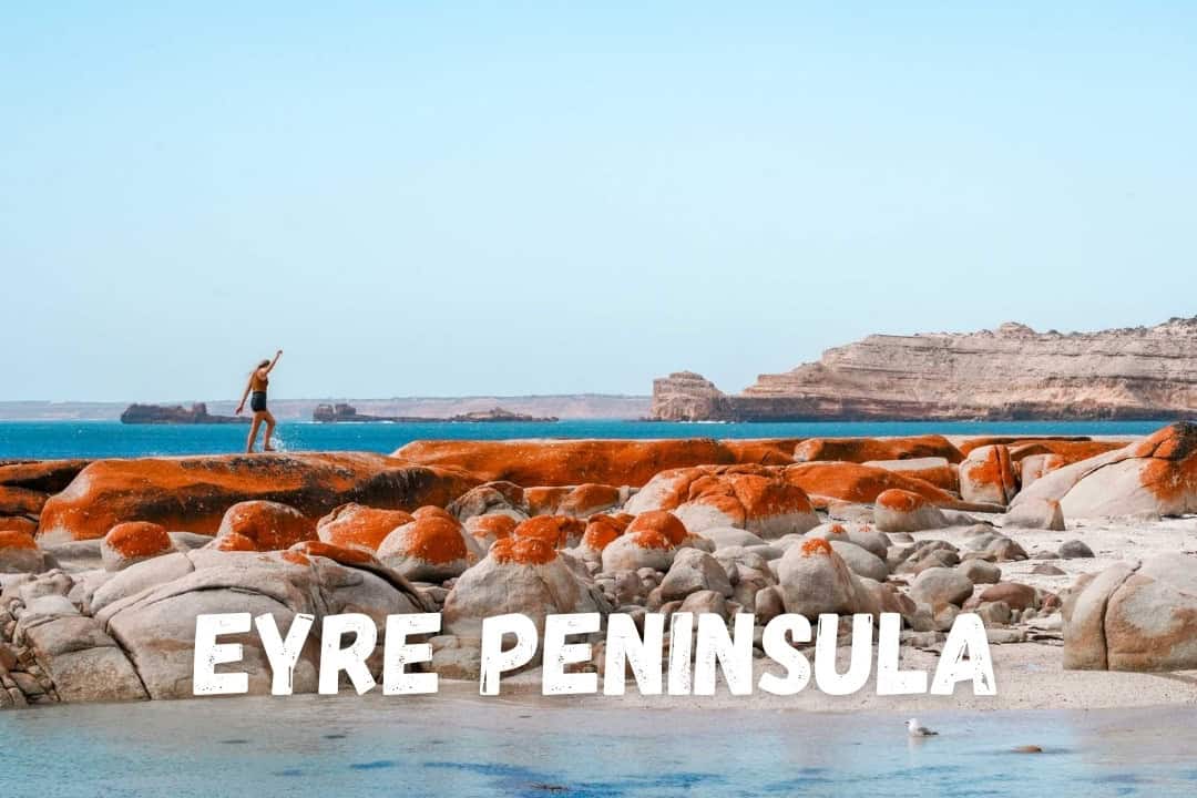
The Eyre Peninsula is probably our favourite part of South Australia, and also the part most people drive straight past on their way to Western Australia.
The beaches are incredible. Sea lions will circle around you. You can eat oysters within sight of the racks they came off, tackle some incredibly fun 4WD tracks, a pink lake and the best free camping in South Australia.
It’s also big. Drive the loop from Port Augusta down to Port Lincoln, up the west coast to Ceduna and back inland through the Gawler Ranges and you’ll clock around 1,500 kilometres before you’ve taken a single detour. Add the run from Adelaide and you’re at 2,000-plus.
➤ Start with our Eyre Peninsula Road Trip guide with a map to plan our trip.


Best time to visit the Eyre Peninsula
We’d say April. Warm enough to swim, campgrounds half empty, if the timing is right, campfires are allowed again, and the sunsets from the west coast are something else.
Winter is when the wildlife turns up. Giant cuttlefish gather in their tens of thousands at Whyalla from about May to August, with the best in June and July. Southern right whales come into the Head of Bight from May to October, peaking in August and September.
Summer is best for swimming, but it’s hot and school holidays make it incredibly busy everywhere.
One warning: the wind down south is brutal, and it gets cold. At Whalers Way, we gave up on swimming the first day because of the wind.
How long do you need on the Eyre Peninsula?
More than you think. Everyone underestimates this one.
Road trip and itineraries
Do the Eyre as a loop. Go down the Gulf Coast through Cowell, Arno Bay and Tumby Bay to Port Lincoln, then up the west coast to Ceduna, then back inland through the Gawler Ranges and Kimba.
➤ Coffin Bay National Park is one of the highlights of this area. The southern half is sealed and 2WD-friendly. The northern half is 4WD only, and it’s where the good stuff is.
➤ Whalers Way is private land on the southern tip. You need to buy a $40 vehicle permit, which includes one night of camping.
➤ Memory Cove is our favourite place in the whole of South Australia. They only allow 15 vehicles per day, and you collect a physical key at the Port Lincoln Visitor Centre to get through the gate. Book weeks ahead, or months for school holidays.
Heading west? Check out our guide to crossing the Nullarbor, which covers the quarantine stations, fuel stops and the ten things we wish we’d known.
Camping on the Eyre Peninsula
The national park campgrounds here are incredible. $14.40 vehicle entry and camping from $23.10 a night, with Memory Cove at $34.10.
There are also council campgrounds along the lower west coast between Coffin Bay and Elliston. Point Drummond is only $5 a night. And Greenly Beach South, the three SHeringa camps, and Tractor Beach on the Westall Way Loop are all low-cost and bookable through the council.
What you’ll notice when camping on the coast: a view and shelter from the wind are usually a trade-off. Look at the forecast before you pick a site.
Explore the Flinders Ranges
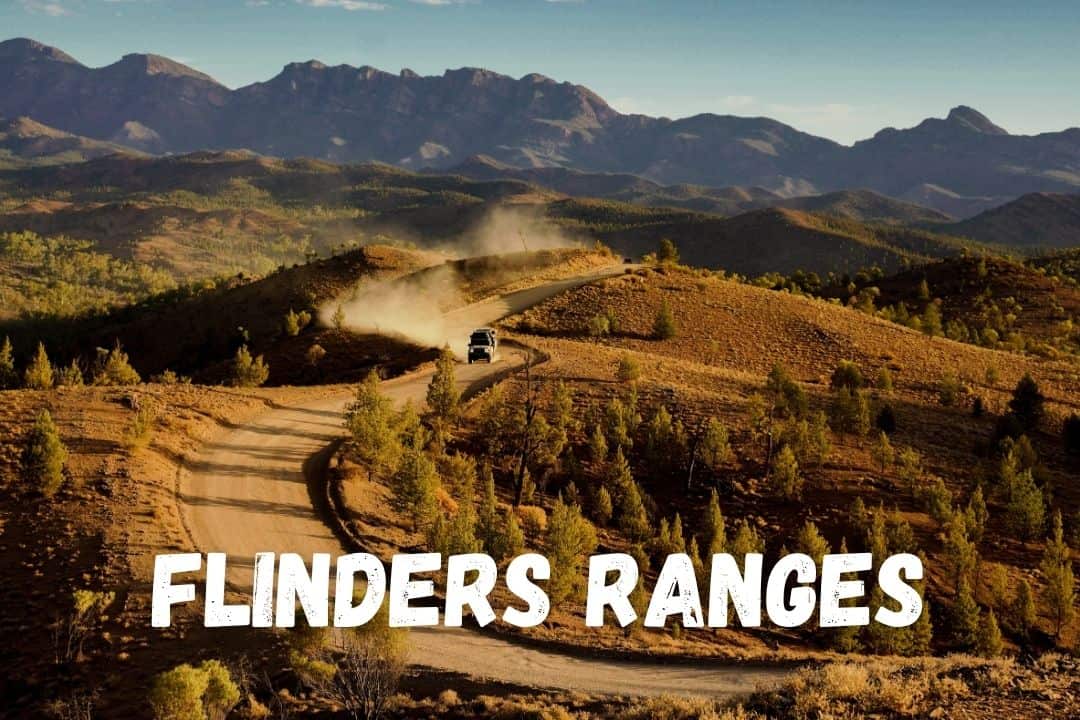
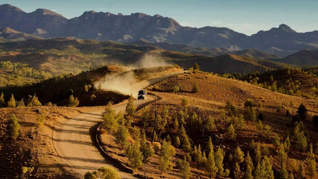
The Flinders Ranges are the outback counterpart to everything else on this page and they’re only five hours from Adelaide.
This is ancient country. The rocks in Brachina Gorge are between 800 and 500 million years old, and there’s a small brass plaque near Trezona Campground marking the start of the Ediacaran Period, the first new geological period declared in 120 years. It’s the sort of place where you’re standing on the oldest evidence of complex life on Earth, and there’s nobody else in the car park.
Expect red dirt, ancient gorges, scenic drives, yellow-footed rock wallabies, outback pubs with very good pies, and some of the darkest skies in Australia.
➤ Start with our 3-day Flinders Ranges itinerary. A self-drive loop we actually did, with costs and current road conditions.

Before you go
Two big rain events in lat eFebruary 2026 caused more than $10 million of damage to roads across the Flinders Ranges Council area, and a lot of it still isn’t repaired.
As of September 2026, Bunyeroo Gorge Road and Brachina Gorge Road remain closed pending repair works, along with Moralana Scenic Drive and Glass Gorge Road. Those are three of the best drives in the region. Parachilna Gorge Road is open with high clearance recommended, and the sealed Flinders Ranges Way is fine.
→ Check the SA outback road report and the park alerts page before you go.
Best time to visit the Flinders Ranges
April to October is the best time. April, May, September and October have warm days, good light and you can enjoy a campfire.
June to August is beautiful and empty, but expect nights near freezing.
December to February regularly tops 40°C. Hiking becomes dangerous and camping miserable. And don’t even get me started on the flies…
Wildflowers are best after winter rain, roughly August and September.
How long do you need in the Flinders Ranges?
➤ For more inspiration, have a read through our 3-day Flinders Ranges itinerary.
Road Trips and Itineraries
The Flinders work as a loop from Adelaide via Port Augusta, Quorn and Hawker, and they’re the natural step after the Yorke or Eyre Peninsula.
➤ Have a read through our guide to the best 4WD tracks and scenic drives in Flinders Ranges, which covers Bunyeroo, Brachina, Moralana, plus three station tracks: Skytrek, Arkapena and Caernarvon..
Camping in Flinders Ranges
There are ten campgrounds inside Ikara-Flinders Ranges National Park, from $27.50 per night, all bookable online, all basic, with a long-drop toilet, fire pits, and no water. Vehicle entry is separate and costs $14.40.
Outside the park you’ll find station stays at Rawnsley Park, Willow Springs, Merna Mora and Arkeba, plus free camps along Williams Way south of Hawker and in Parachilna Gorge.
Not that dogs aren’t permitted in Ikara-Flinders Ranges National Park. Rawnsley Park station has pet-friendly cabins and a dog-minding service.
➤ We’ve compared all campgrounds, free camps and station stays in our Flinders Ranges Camping Guide.